We have been developing spatial solutions for various fields for over 15 years.
We create user-friendly applications that allow you to interact with and analyze geospatial data seamlessly.
Our solutions integrate various data sources, providing a comprehensive view of your geographical information.
We transform complex data into intuitive visualizations, helping you uncover insights and trends
CAD data is a powerful source of information, and we know how to utilize it effectively.
Creating 3D maps for use in three-dimensional geoportals, simulators, and virtual reality training.
From initial consultation to ongoing support, we are with you every step of the way to ensure your GIS system meets your evolving needs.
For full project presentations, please contact us.
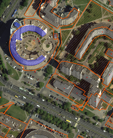
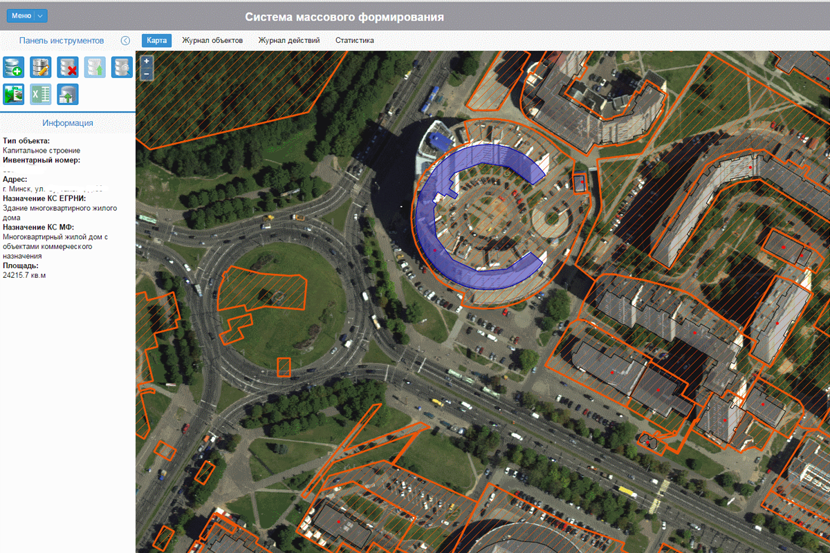
Corporate Geographic Information System
Objective: To create a digital model of the company's infrastructure. The solution is universal; although it was initially developed for railways, it can be applied anywhere the client has extensive infrastructure.
It is based on open-source products and proprietary solutions, which allowed for a complete rejection of purchasing software licenses.
CAD documentation was used as initial data, which significantly reduced costs for populating the system with data and further maintenance.
In the competition "Best IT Projects for the Oil and Gas Industry" , the solution won in the category "Digital Factory."
Contact us to receive a detailed presentation on the project.
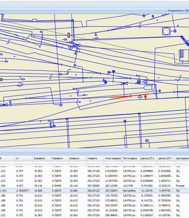
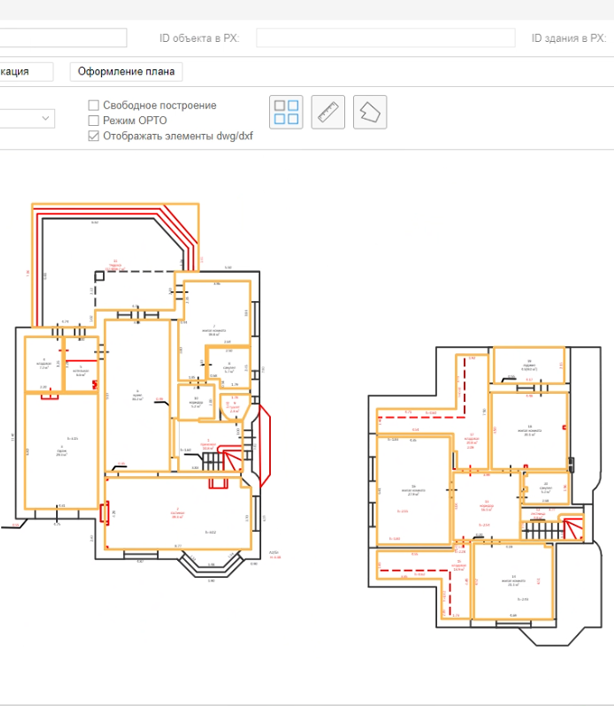
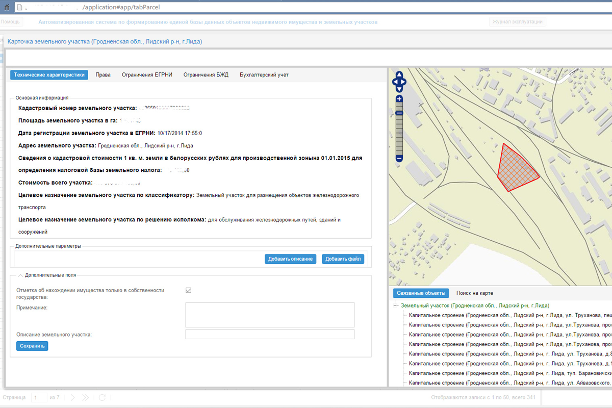
An example of the possibility of working with design documentation (CAD) using GIS technologies.
The system for compiling and maintaining floor plans is designed for automated compilation of two-dimensional models (floor plans) of buildings, parts of buildings, isolated rooms and their parts, parking spaces, structures.
The system is developed on the basis of open source products and our company's own developments.
The implementation allowed:
- to refuse the use of AutoDESK products
- to standardize elements in drawings
- to standardize elements in drawings
- to automate calculations
- to organize multi-user work with drawings
Which led to the acceleration of business processes, a decrease in the number of errors, and the refusal of licenses for AutoDESK products.
Contact us to receive a detailed presentation on the project
During our work, we have implemented dozens of projects in the field of working with spatial data in various areas: tracking, cadastre, infrastructure, public administration. If you are interested in our other developments, contact us and we will tell you in detail about our experience.
Geoportals are sites containing cartographic information. As a rule, for communication between state and municipal authorities and residents.
Corporate GIS are intra-corporate geoportals integrated with the internal systems of the organization (ERP, accounting, etc.) and external (usually government agencies) And as a rule, they contain spatial information about the organization's accounting objects. Both fixed (infrastructure, buildings, land plots) and mobile (tracking). Storing the entire history and generating the necessary reports.
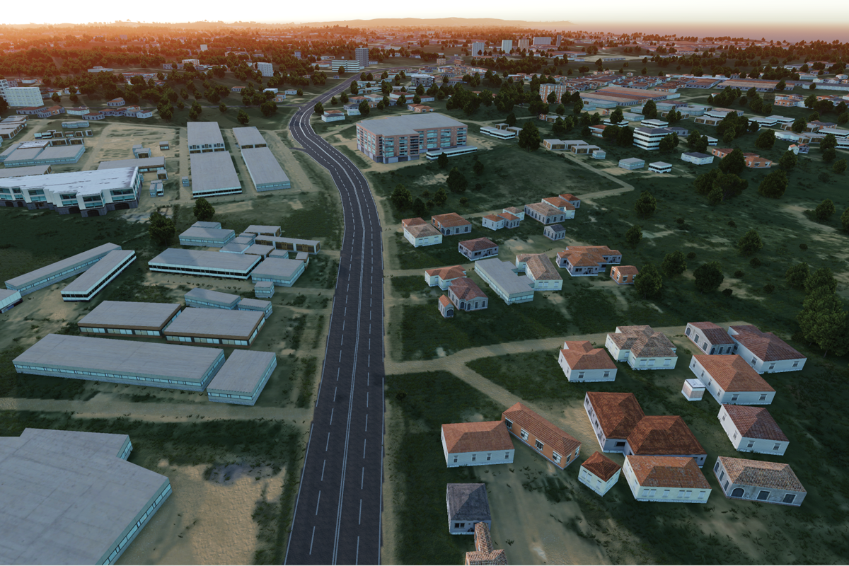
Development of 3D maps of territories for various types of training and simulation equipment. VR applications development.
years
projects
developers
cups of coffee :)
We are a unique team of like-minded people and professionals who have a deep knowledge of both the field of working with spatial data and modern IT technologies, which allows us to create unique solutions. We have successfully implemented dozens of projects in various fields: transport, cadastre, infrastructure management, technological industrial solutions, simulators.
During our existence, we have been able to develop and implement not only dozens of projects, but also gain invaluable unique experience, allowing us to find optimal solutions for our Customers. A deep understanding of technologies and solutions, primarily open source, as well as the availability of our own developments, allow us to find optimal solutions in terms of price / quality, which distinguishes us favorably in the market. We are constantly improving, discovering something new, finding unique solutions at the intersection of various technologies and directions.
Any work scheme will suit us. We try to flexibly adapt to the needs of the customer. We are ready to work both on a project basis and on an hourly basis (Time and Materials).
We work with both open DXF and DWG formats.
Everything is very individual and depends on the current workload of our specialists. In any case, we have reserves for new projects.
We evaluate each project individually. It depends on many factors: the duration of the project, what specialists and what level are required, urgency, choice of technologies, etc. Write to us and we will evaluate your project and give our expert recommendations for implementation.
Depends on the project and the wishes of our customers. As a rule, we allocate about 20 hours of work of our specialists for the examination, but if necessary, it can be more. At the output, you receive proposals for implementation, the proposed stack of technologies and a rough estimate of the implementation time and cost.
We hear this from every customer :) But to answer this question, we must first study your project. We have done "impossible" projects many times.
More questions? Ask here
To become a reliable partner for business, helping to optimize and automate processes and reach new heights.
Share your ideas and we will be happy to share our experience with you.
Your message has been sent!