Here are some of our projects. For detailed information, contact us.
Geoportal, real estate
Corporate geodata system intended for automation of customer's business processes.
The system implements the following tasks:
• automation of mass formation process of immovable property objects;
• storage of data obtained during mass formation process;
• output of data obtained during mass formation process to whom it may concern.

VR, simulator
Full project name: Development of a simulator with imitation of the effects of physical impacts in virtual reality.
Project goal: to develop an experimental model of the simulator, including software and elements of imitation of the effects of physical impacts on the student in virtual reality for use in the educational process in the training of emergency rescue service specialists.
The use of the simulator allowed the cadets of the Ministry of Emergency Situations to develop and consolidate the skills of behavior in extreme situations (during fires) without a threat to life. And it will allow instructors to evaluate the quality of behavior in dangerous situations.
The use of a feedback suit allows cadets to receive feedback and correct errors directly during the training process.
The analytics subsystem collects information on the actions and condition (pulse, etc.) of each student, analyzes learning progress, and also analyzes group dynamics, compares the results of both individual cadets and groups
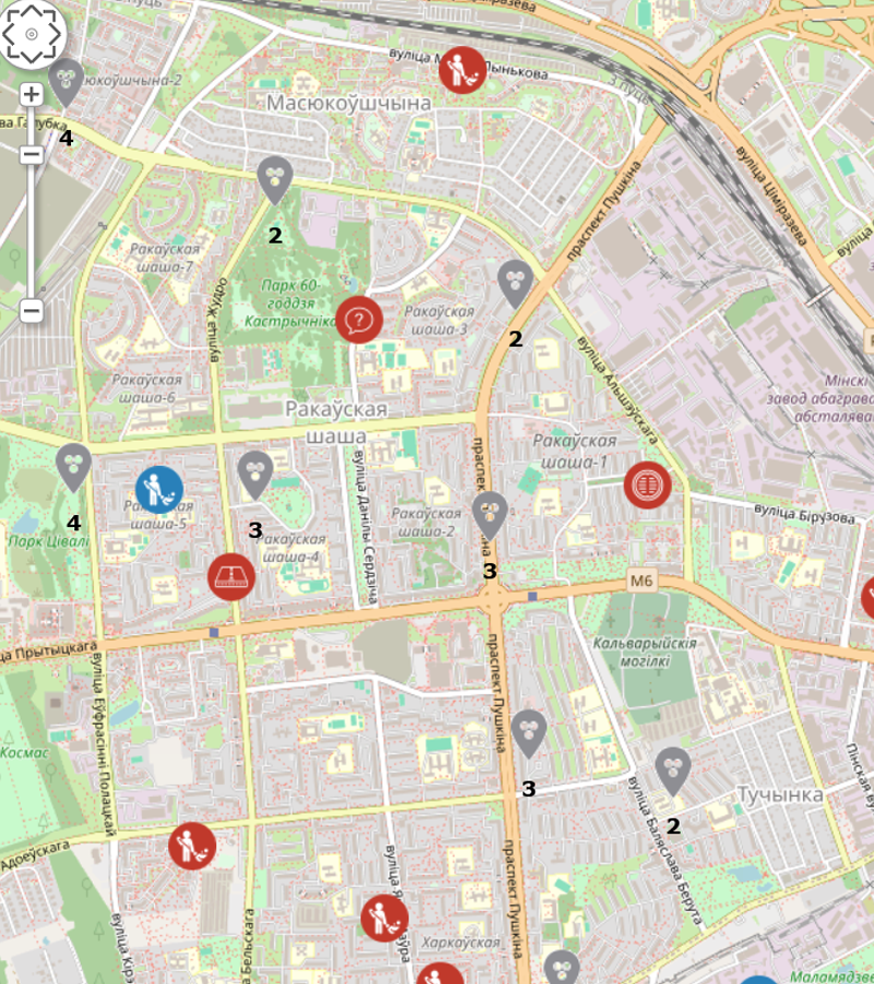
Geoportal
Geoportal allows citizens to effect smart informing of the utility services regarding the problems in the Housing-and-Utility Infrastructure sphere. Each problem is given definite geographic affixment, possibility to add a photo and description, as well as to receive the report when the problem is solved. An inquiry is automatically sent to corresponding service, and, after that, the user can track its status, comment and give recognition of the company’s work. Shared coordination center allows to synchronize operation of the utility services.
The project main tasks included:
• simplifying of communication between the residents and the housing-and-utility services of the country;
• time reduction between the inquiry applied for the works to be implemented and the problem solvation;
• data collection regarding current infrastructure state to reveal “weak points” and prevention of the emergency situations in the future;
• obtaining of smart feedback from the population regarding the problems in the Housing-and-Utility Infrastructure sphere;
• synchronizing of operation of the utility services;
• creation of shared coordination center in regard to the problems of the population;
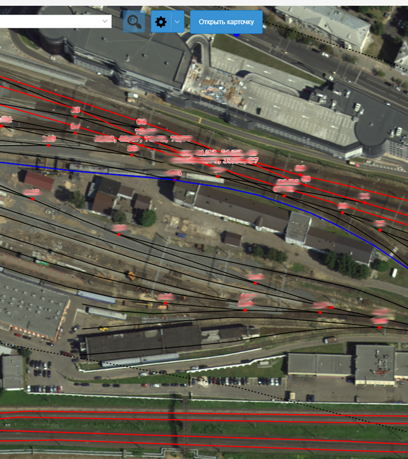
GIS, infrastructure, analytics
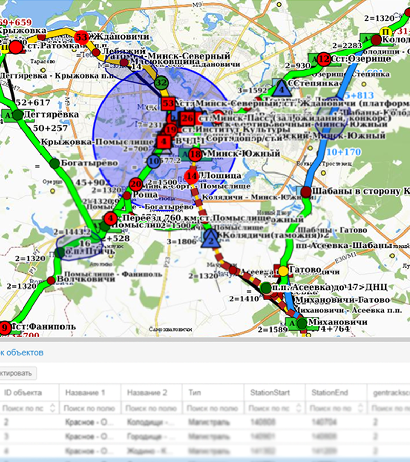
Automated system of access administration to branch model diagrams of Railway The system is intended for operating the object sets of the railway infrastructure and their parameters.
The system allows generating various data sets for different services depending on the tasks they face and their responsibility areas. The data can be conventionalized regarding the tasks faced. Flexible system of settings in regard to the reports and the possibility of printing allows to print generated and conventionalized data sets (the atlases) of large sizes and to use printed versions in operation.
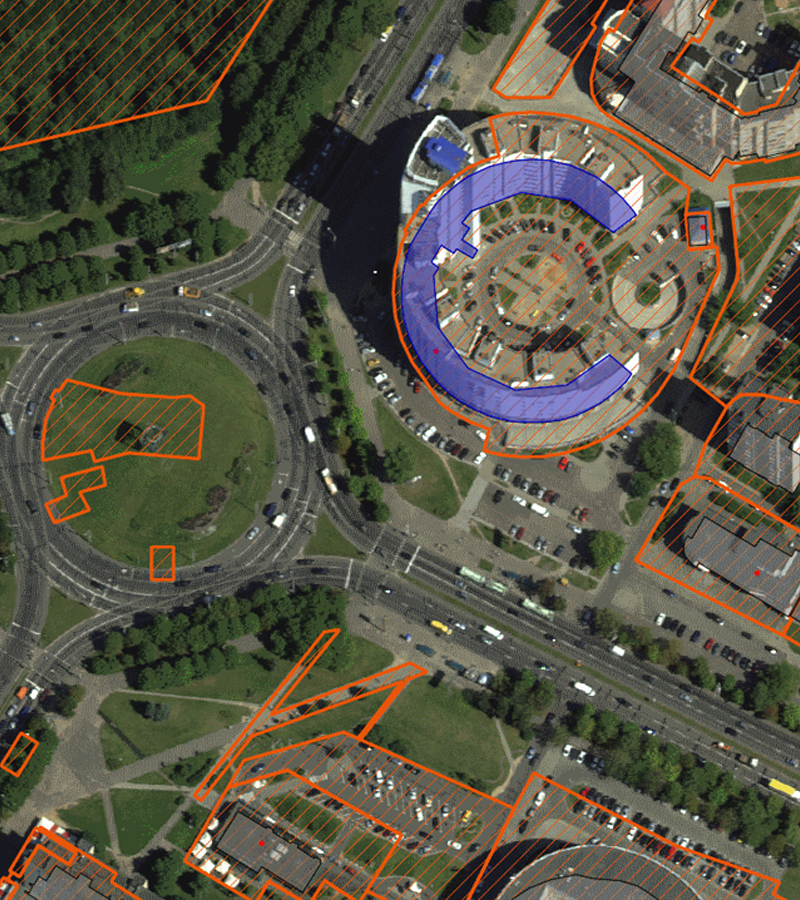
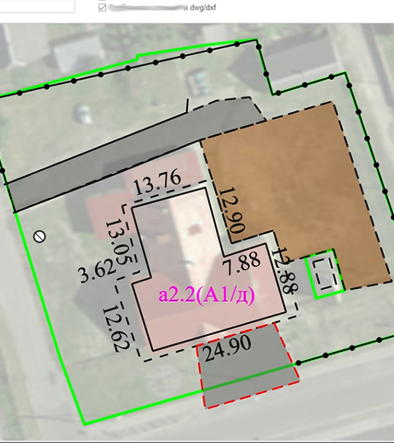
GIS, real estate
System is intended for automation of activity of the large enterprises, regional and municipal institutions implementing administration of the immovable property: the land lots, the buildings located within their limits, the facilities, isolated premises and utility lines.
The system generates a unified card of the immovable property object by means of data collecting and comparing out of various sources: “Unified State Register of Real Estate and Property” and accounting data system of a company.
The system automatically builds up the hierarchy of accounting objects. Thus, having clicked the land lot, it is possible to view the list of the buildings located within the limits of this land lot; and having clicked the building, it is possible to view the list of premises located inside of it.
The system allows obtaining full data in regard to any accounting object, simplifying the work of the accounting department, preventing mistakes while payment of taxes, as well as revealing of the mistakes that are possible to occur within the state recording system.
GIS, infrastructure
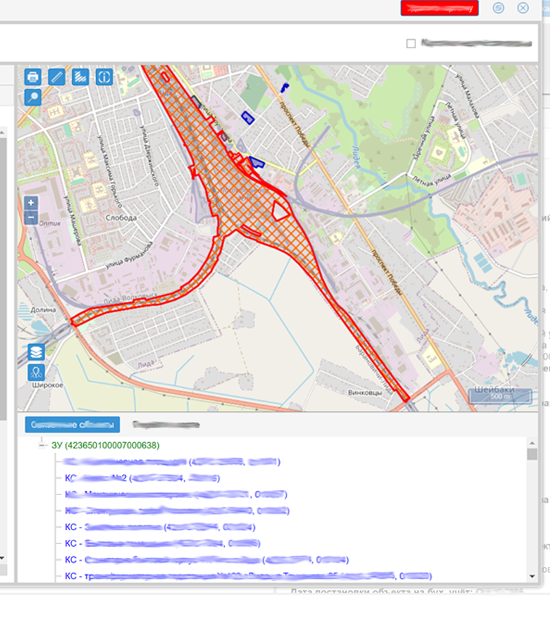
Complex solution to maintain data storage, updating and systematizing processes regarding the track facility within the limits of the responsibility areas of the track maintenance divisions, which includes:
• database and web-interface providing data logging regarding the track facility objects within the limits of the responsibility areas of the track maintenance division;
• database of the regulatory-and-referential documents.
Corresponding registering forms are created for all the track facility objects; these forms include a set of the attribute fields and variable attributes, on the basis of which the reports for accounting period (quarter, half a year, a year) are formed; these reports can be exported into docx and xlsx formats.
Data of the regulatory-and-referential data tables, with geographic or linear coordinate affixment, is displayed at out-of-scale drawing (scale-model plan) by means of corresponding conventional symbols.
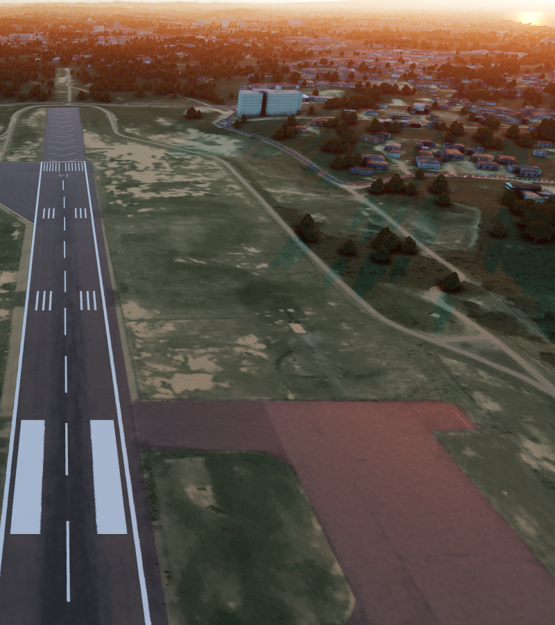
VR, unreal
3D model of Labuan Island (Malaysia).
The 3D map is a complete digital twin of the island and can be used to solve a large number of engineering and municipal problems using virtual reality systems and geo-systems. And it can also be the basis for creating various kinds of simulators and trainers.
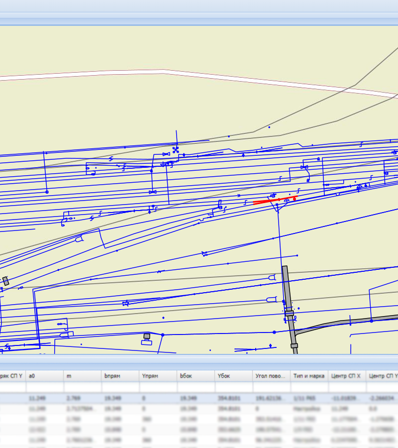
GIS, infrastructure
System is intended for data storage and output regarding the company’s infrastructure objects, as well as for simplifying the access to data by means of web-interfaces.
Data within system is formed according to the rules of an object model, which input data are CAD-documents of a company.
Due to the fact that the system comprises the whole spatial and attributive data regarding the infrastructure objects, it can serve as a basis for development
of various applications and services: atlases of the stations/stop platforms,
mobile infrastructure applications, building-up of the track longitudinal profile. It is also possible to create
graphic model of the underground utility line containing position coordinates of important units, route curve, branching, etc.
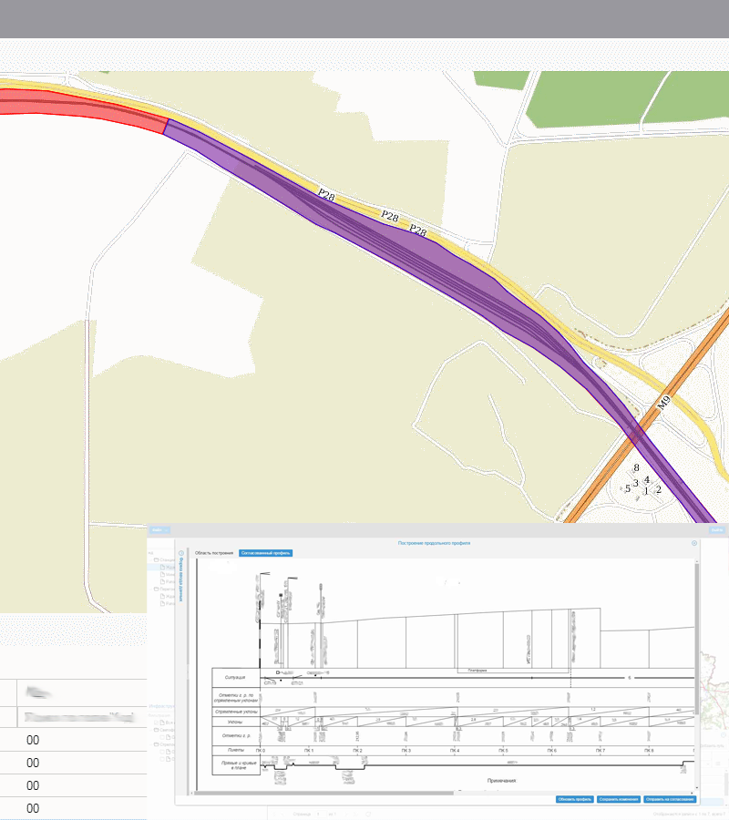
GIS, infrustructure, analytics
The project which allows automatic building-up of a track longitudinal profile on the basis of geodetic surveying data and data of the infrastructure objects of a company.
First of all, automatic building-up of a longitudinal profile permits to avoid the mistakes while data plotting onto a drawing (human factor), as well as to reduce the expenses and to speed-up working process.
The systems consists of several subsystems.
- cartographic material visualization
- administering
- automatic building-up of the Track longitudinal profile.
- obtaining the results of engineer-and-geodetic surveying.
- data access for external systems.
GIS, CAD-GIS integration
An example of the possibility of working with design documentation (CAD) using GIS technologies.
The system for compiling and maintaining floor plans is designed for automated compilation of two-dimensional models (floor plans) of buildings, parts of buildings, isolated rooms and their parts, parking spaces, structures.
The system is developed on the basis of open source products and our company's own developments.
The implementation allowed:
- to refuse the use of AutoDESK products
- to standardize elements in drawings
- to standardize elements in drawings
- to automate calculations
- to organize multi-user work with drawings
Which led to the acceleration of business processes, a decrease in the number of errors, and the refusal of licenses for AutoDESK products.
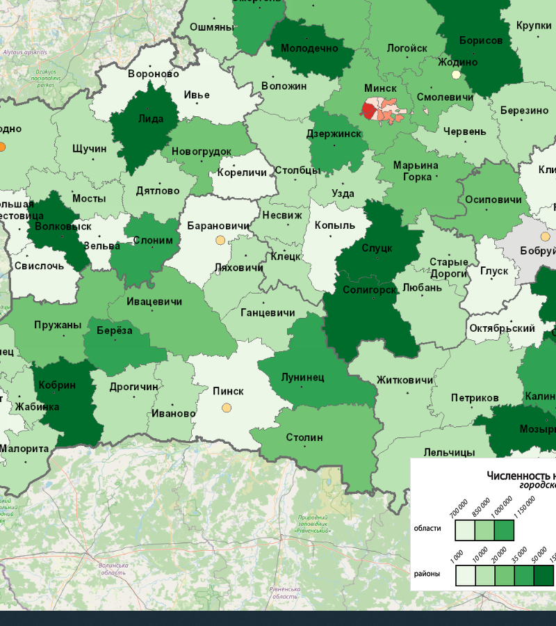
Geoportal
Providing users with access to spatial data and official statistical information. Comparing Information with relevant geographic objects. Analyzing data in cartographic representation, including final data from population censuses. Solving practical problems of government agencies, international statistical organizations, and individuals. Increasing user interest in Information through cartographic representation of information. Main capabilities of the geoportal Studying the relationship between official statistical information and geographic objects. Visualization of information in the form of thematic maps. Providing users with access to spatial data and Information. The results obtained can be saved as images and pdf files. The system contains more than 1000 layers of data!